Google updated a whole bunch of their Android apps this afternoon, including Google Earth. Quietly included in that update is the new
3D imagery that they
unveiled a few weeks ago.
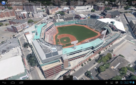
As we already knew, it's a limited number of cities that have this feature at the start. That said, it's a fairly impressive list of cities:
Boulder, Boston, Charlotte, Lawrence, Los Angeles, Long Beach, Portland, San Antonio, San Diego, San Francisco, Santa Cruz and
Tampa in the United States, along with
Rome, Italy.
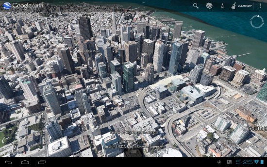
The imagery is very impressive from the air, though fairly rough from ground level. I expect that quality to improve greatly over time. If you're not seeing the 3D imagery, be sure that the "3D buildings" layer is enabled.
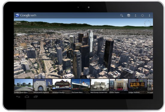
In addition, they've included a new
Tour Guide feature to help guide you around to popular destinations in various cities. You'll see a strip of images at the bottom of the screen in Google Earth that you can click and play.
This update is
available right now from Google Play, and will be available for iOS devices soon. Still no word on when this 3D imagery will arrive on desktop versions of Google Earth, but we'll be sure to let you know when we find out.
(via
Google Lat Long Blog)