It’s obviously very early days, but some of my initial thoughts are as follows:
Finally, some cohesion!
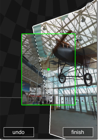
Internally, the MS Photosynth team has been part of the Bing Maps team for several years, but with not much obvious link between the two technologies (other than a fairly trivial way of linking the location of photosynths to a map). More recently, the Bing Maps team became part of the Bing Mobile team. Again, other than the fact that Bing Maps was a component of the WP7 OS, there wasn’t much obvious reason why……finally, we’re now starting to see publicly some of the reasoning behind these decisions, and the strategic direction that MS is taking to try to integrate these technologies. For an example, check out the section of the video above, from about 00:45 to 01:30. You’ll see a (3D) Bing Maps street view, with overlaid thumbnails from streetside (car) imagery. This then changes to a horizontal pan along the street images (streetslide), before cutting to a video link entering into the shop. These video transitions link two photo panoramas shot inside the building, which incidentally, could have been recorded by almost anyone using the new iPhone photosynth app….

So, that’s Bing Mobile, photosynth, and maps working together for the first time in an application…
Licensing
It’s interesting that, even though this technology has only just been publicly previewed for the first time and is far away from being production-ready, Microsoft have already published an initial explanation of the licensing rights involved in the project. This is obviously something they want to make sure they get right.Another interesting thing to note is that Microsoft have publicly stated a strong support for the Creative Commons licences throughout the project, with content creators of photos, videos, or panoramas used in Read-Write world retaining “complete control over whether others, including Microsoft, can display it, mash it up, or otherwise present it.”.
I wonder if this is any way a response to some of the recent criticism levelled at the Google MapMaker product (also demo’ed at Where 2.0), which encourages “citizen cartographers” to add their own data to Google Maps but, in doing so, relinquish their rights to that data to Google. (Compare this to Open Street Maps, which has been enabling citizen cartography for many years and uses the Creative Commons ShareAlike 2.0 licence, which allows anyone to use OSM data so long as it is credited appropriately).
There’s already announcements that Bing will be working with 360 Cities to use (and re-use) CC panoramas, as well as CC images through Flickr.
No comments:
Post a Comment