GEB Weather Tools
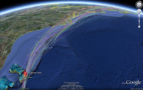
A great place to start is with our collection of Weather tools. While there are a lot of useful tools to be found in there, of particular interest is the hurricane tracking predictions you can find if you follow the following steps inside of the KMZ file:
- Large Collection of Atlantic Weather Overlays
- Tropical Atlantic Overlays
- Hurricane Model Data
- North Atlantic Basin
- Hurricane Irene
- North Atlantic Basin
- Hurricane Model Data
- Tropical Atlantic Overlays

Live Hurricane Hunter Data
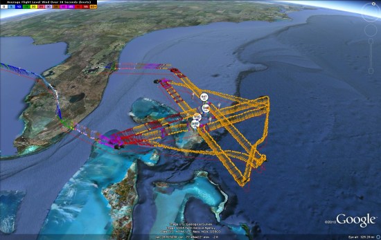
A few years ago, we showed you the hurricane hunter recon data which is collected and produced by the folks at Tropical Atlantic. Their KMZ file is updated in near real-time during missions, and you can view historical data as well. Shown below is a run they did yesterday, showing wind speeds from various areas of the hurricane. You can click any of the colored barbs to view detailed statistics for that location at that time. The amount of data available through their system is quite staggering.

Google Earth's Built-in Tools
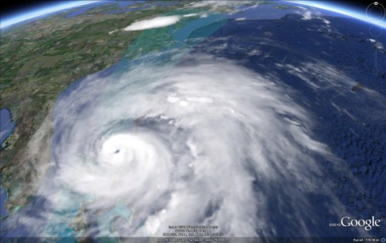
Finally, you can always use the tools built-in to Google Earth. The data isn't as detailed as some of the other sources, but it's easier to access to get a quick look at things. Under the "weather" layer you'll find satellite and radar imagery, and enabling the "places" layer will reveal an icon on top of the hurricane which can be clicked for more information.

As always, please let us know if you're aware of any other great Google Earth-based tools for tracking Hurricanes, and we'll be sure to pass along the information to our readers.
No comments:
Post a Comment