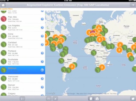
SAP is planning to add some new tools in the coming months to help integrate their business analytics software with Google Earth and Google Maps. With tens of billions of dollars in annual revenue, SAP is a massive company and this kind of integration will be incredibly useful for thousands of businesses around the world to get a better understanding of their data.

Given the widespread use of SAP and the volumes of data that companies have stored in it, the possiblities for geo-related use cases are incredible. Here are a few that SAP mentioned:
- A telecom operator could use Google Earth to perform dropped-call analysis and pinpoint the geo-coordinates of faulty towers.
- A state department of revenue could overlay household tax information on a map of the state and group it at the county level to track the highest and lowest tax bases.
- A mortgage bank could perform risk assessment of its mortgage portfolio by overlaying foreclosure and default data with the location of loans on Google Maps.
- A team of customer support representatives in a consumer packaged goods company could collaborate and pinpoint the location of consumer complaints within specific geographies and make a decision regarding how to address and prioritize resolution.
- A theme park operator could use the Google Maps API Premier and get real-time traffic information on attractions to send rerouting messages to customers in order to improve satisfaction rates.
- U.S. census data could be overlaid on a Google map of the country, grouped by state and drilled down on at the county level.
No comments:
Post a Comment