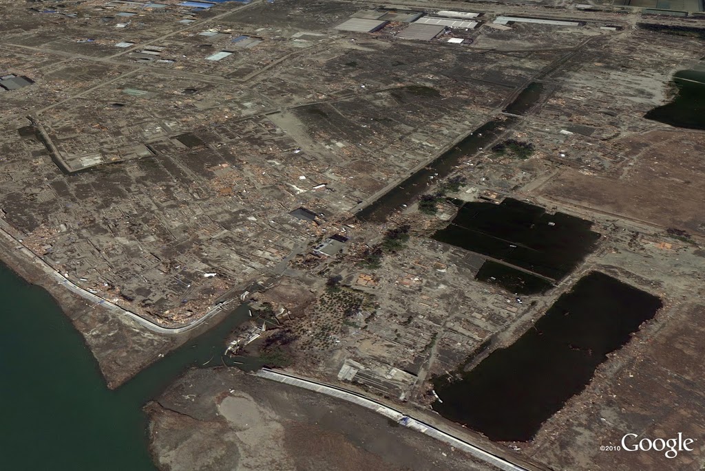
We’ve been looking for ways we can assist in the relief efforts using Google’s map-related tools. A few days after the quake, we published updated satellite imagery of northeast Japan in Google Maps and Google Earth, which illustrated the massive scale of devastation in the affected areas.
Today, we’ve published imagery of the Sendai region at even higher resolution, which we collected on Sunday and Monday. The new Sendai imagery, along with satellite imagery from throughout the area, is now live in the base imagery layer of Google Earth and will soon be visible in Google Maps. We hope to continue collecting updated images and publishing them as soon as they are ready.
We hope our effort to deliver up-to-date imagery provides the relief organizations and volunteers working around the clock with the data they need to better understand the current conditions on the ground. We also hope these tools help our millions of users—both those in Japan and those closely watching and sending their support from all over the globe—to find useful information about the affected areas.
A riverside neighborhood in Sendai from our newly released imagery
Posted by Keiichi Kawai, Senior Product Manager, on behalf of Google Japan and international Crisis Response teams

No comments:
Post a Comment